Typhoon Noul Expected to Affect Cebu Around July 25
A tropical depression has formed in the waters east of the Philippines.
Because it developed within the Philippine Area of Responsibility (PAR), the local weather agency assigned it the domestic name “Kiyapo.”
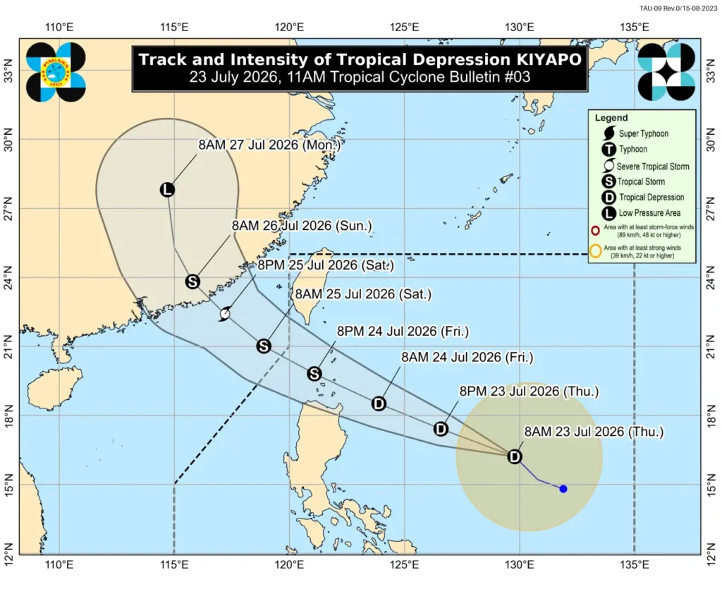
According to PAGASA (Philippine Atmospheric, Geophysical and Astronomical Services Administration), Tropical Depression Kiyapo formed at around 8:00 AM on July 23. It is forecasted to intensify into a typhoon within the next 24 hours. Once it reaches typhoon strength, it will be named Typhoon Noul (Typhoon No. 12).
Forecast Path & Impact on Cebu
Kiyapo is currently moving northwestward and is expected to develop into a full-fledged typhoon by around 8:00 PM on July 24 as it approaches northern Luzon. The current forecast trajectory shows Typhoon Noul forming north of the Philippines and continuing its northwest track toward mainland China.
While forecast paths are subject to change, the system will pass Cebu while still categorized as a tropical depression before becoming a typhoon. However, as it interacts with the Southwest Monsoon (Habagat), strong winds are expected in and around the Cebu region.
Correspondingly, rough sea conditions and high waves are anticipated. The impact is expected to last from July 24 to July 25, with the strongest effects likely felt on Saturday, July 25.
⚠️ Travel Advisory for Weekend Travelers
If you are planning a trip to Cebu this weekend, please make sure to monitor the latest weather forecasts closely.
If you have outdoor activities scheduled—especially island hopping tours, scuba diving, or water sports on Saturday—we strongly recommend contacting your tour operators in advance for safety updates and schedule changes.

![[Moalboal Advisory] Island Hopping & Boat Diving to Pescador Island Temporarily Suspended (February 22, 2026)](https://en.mycebutrip.com/wp-content/uploads/2026/02/moalboal-pescador-island-hopping-suspended-20260222-768x922.webp)